hot springs

Meager Creek Hot Spring Retreat

Meager Creek Hot Springs is a beautiful hot spring pool that lays towards the north end of the Pemberton Valley. A very well-developed site, it is (was) easily accessible by car, and purportedly used to see up to 30,000 visitors per year. On August 6, 2010, at 3:30am, initial failures began, with the secondary peak of Mount Meager collapsing 45 seconds later, releasing ~48.5million cubic meters of rock. The rock travelled at an estimated 240km/h down Capricorn Creek. This was one of the largest landslides to occur worldwide and one of the three largest landslides in Canadian history. This landslide took out the bridge that people would use to access the Meager Creek hot springs, and they rarely see any traffic these days due to limited access.

In the last few years, the Varsity Outdoor Club (VOC) has established a hiking trail that accesses the Harrison backcountry hut. An awesome side note: it also gives hiking access to the hot springs without having to cross the river. Sara and I had planned to do this hike for about a year, and we were excited to finally get a chance to do it in such great weather - sunny weekday, with a full moon to boot.

With very little net elevation gain (actually a loss once you descend into the valley to reach the springs), we expected the hike would be a breeze. That idea was soon thrown out the window though, as we found the trail had some aggressive side-hilling with lots of ups and downs. After a 4 hour jaunt, we found ourselves at the springs, with not a soul in sight, and our sore muscles found great relief in the soothing tubs. 

Thinking about this trip beforehand, I had a vision of a nighttime portrait of Sara and I in the springs, with stars in the sky. Given that we had the full moon, I had to slightly change my original idea. I ended up getting a shot of us I will treasure for years to come, and it proved to be worth hauling my damn tripod and flashes in on the 10km hike!

The hike began through a nice patch of old growth

It continued on through a ragged trail with orange markers interspersed to line our route

Sara and Tiva enjoy a great view of the Capricorn Creek slide area

Self-portriat, 2am under full moon


South America Part II with a Daily Vote Reminder!

Another quick reminder to help me out with a daily vote on this MEC contest! If you could simply click on the link below, and vote for my photography entry about hiking, you could help me win a hiking trip to the Arctic! Thanks for helping!! http://promoshq.wildfireapp.com/website/6/contests/324364/voteable_entries/68689974

Now on to the interesting stuff. I met up with my travel group in Santiago (check out GAP Adventures, they're a bit pricy, but if you don't speak the language well it helps a lot), and we headed south via an overnight bus ride to the town of Pucon, Chile. In my group were me, 3 girls (Lupita, Noora, and Janet), and our tour guide. The town of Pucon showed some rainy weather, so we could not climb the nearby volcano, Villaricca. Instead, we went for a soaking wet hike through a national park to a waterfall, which was pretty fun, given the circumstances. I probably wouldn't have done a similar hike in BC in those conditions, but you need to take what you get when travelling.

The next day we went for some whitewater rafting, followed by a visit to some badass hot springs, 2 activities that are extremely enjoyable in the rain. Afterwards, the guides brought us to their house for a BBQ feast; carne asada and wine in vast amounts. The hospitality down there was absolutely amazing. After 2 days in Pucon, we took off east, crossing the border into Argentina, first visiting a town called San Martin de los Andes. To be continued...

Bristles on a plant in the hostel in Pucon

My travel group for the first half of my trip

Amazing hot springs near Pucon

Carne asada, courtesy of our tour guides

Stray dogs are everywhere in South America, and very friendly

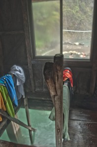
An HDR photo of the hot springs from inside the change room